Land
Land Management
 The District spans multiple vegetation types and extremes of elevation, the conservation activities run the full gamut. Historically the district has worked with conservation agency partners like the Natural Resources Conservation Service to provide technical assistance, cost-share programs to encourage use of conservation practices on agricultural and rangeland, and educational activities. Today the Distrist has three programs each with a different focus 1) Forestry and Watersheds 2) Agriculture and Rangelands 3) Collective Impact – Public Engagement and Disaster Preparedness
Forestry
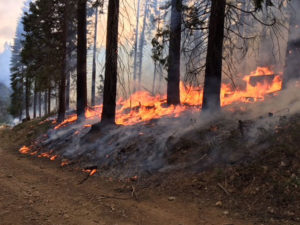
The Sierra Nevada mountains are crucial to the health of the Central Valley economy, providing most of the water that supports the Central Valley. The health of the Sierra’s are compromised by high tree mortality, drought, overgrowth, and wildfire. The size and impact of wildfires have increased dramatically.
Agriculture
Fresno County is the largest agricultural production county in California and the nation, producing over 7.9 billion dollars annually. Fresno County has nearly 2 million acres of dedicated farmland, approximately 50% of the total acreage. The Region represents 30% of the entire State of California’s croplands. Within the district, primary crops are: Oranges, Strawberries, Fruit Orchards, Nut Orchards, Vineyards, Olives, Asian Market Crops, Truck Garden Crops, Cattle &, Rangeland, Dairies,Timber, Honey.
The Central Valley supplies 8% of U.S. agricultural output (by value) and produces 1/4 of the Nation’s food, including 40% of the Nation’s fruits, nuts, and other table foods.
Air
Air Quality
Natural challenges of the San Joaquin Valley, such as the geography, topography and meteorology of the air basin, create a low capacity for air pollution. The Valley topography is shaped like a bowl that holds air with minimal ability for dispersion. The San Joaquin Valley Air Pollution District reports the air quality of the Los Angeles area is only marginally worse than the Valley’s although about 10 times more pollution is emitted in that region. The Bay Area’s air quality is much better than the Valley’s, even though about six times more pollution is released there.
Wildfires in the region significantly impact the air quality of the District and the people who live in the region. Maintaining forest health conditions and implementing wildfire mitigation strategies is a priority for the District that directly impacts air quality.
See the Air Pollution District’s recommendations for healthy air here.
Water
Watershed health
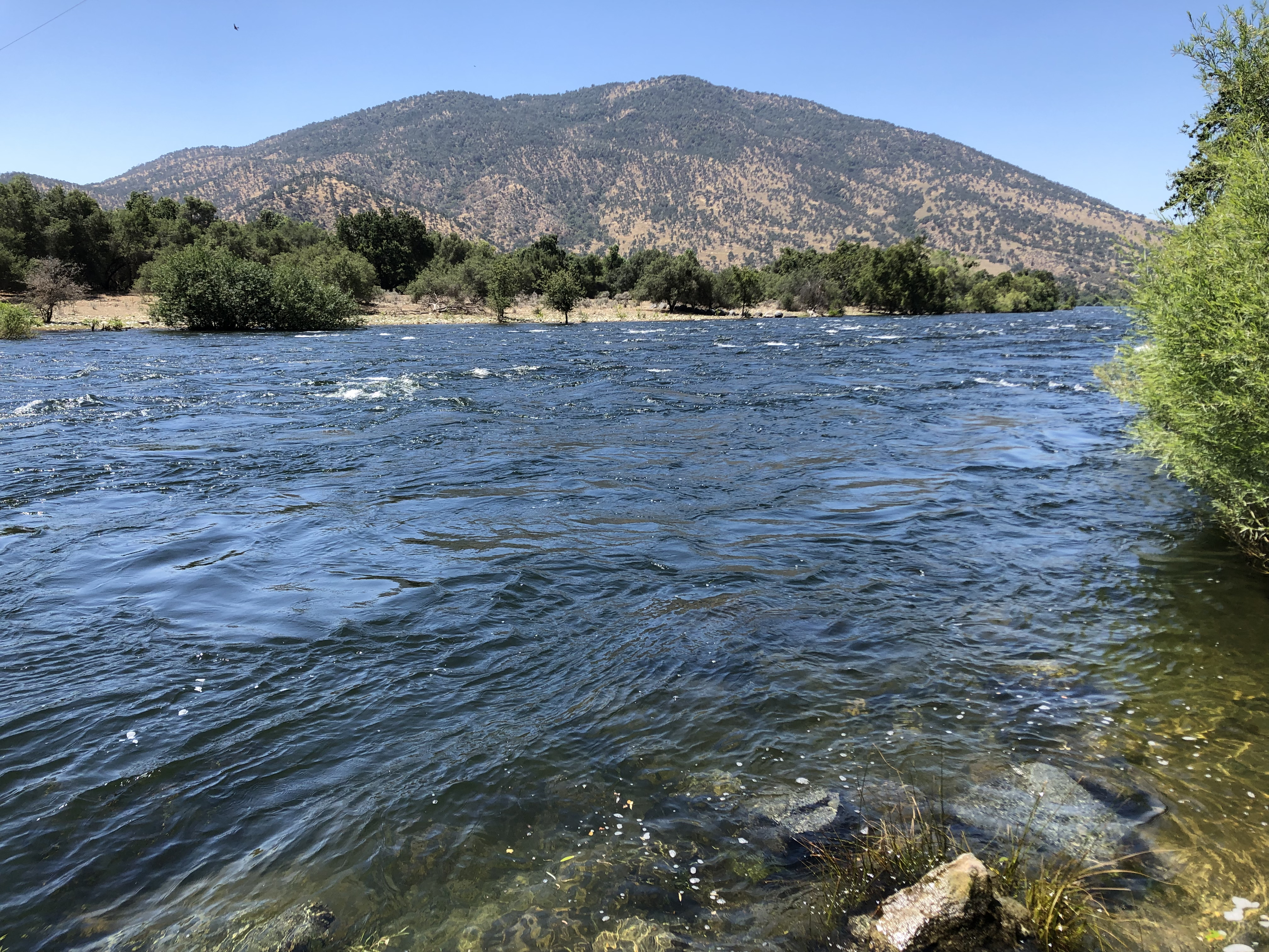
The natural and infrastructure systems within the upper San Joaquin River (1,680 square miles) and Tulare Lake Hydrologic Regions (4,730 square miles) originate within the Sierra and Sequoia National Forests. They have been significantly impaired by drought, effects of climate change, and massive tree mortality in the range of 80-100%. This has contributed to more frequent and greater intensity wildfire events with catastrophic consequences to ecological assets, infrastructure such as hydroelectric production facilities, and placing communities at risk. These forestlands do not have the ability to function properly as the largest natural carbon sink in California and as a source for nearly 65% of the high-quality water used for domestic and agricultural purposes.
The San Joaquin River and the Kings River are the principal rivers that influence the hydrology in Fresno County. The western slopes of the Sierra Nevada drain to the west via the San Joaquin and Kings Rivers.
These natural and infrastructure systems within the upper San Joaquin River (1,680 square miles) and Tulare Lake Hydrologic Regions(4,730 square miles) originate within the Sierra and Sequoia NationalForests and have been significantly impaired by drought, effects of climate change, and massive tree mortality in the range of 80–100%. This has contributed to more frequent and greater intensity wildfire events with catastrophic consequences to ecological assets, infrastructure such as hydroelectric production facilities, and placing communities at risk (CARs). These forestlands do not have the ability to function properly as the largest natural carbon sink in California and as a source for nearly 65% of the high–quality water used for domestic and agricultural purposesThese natural and infrastructure systems within the upper San Joaquin River (1,680 square miles) and Tulare Lake Hydrologic Regions(4,730 square miles) originate within the Sierra and Sequoia NationalForests and have been significantly impaired by drought, effects of climate change, and massive tree mortality in the range of 80–100%. This has contributed to more frequent and greater intensity wildfire events with catastrophic consequences to ecological assets, infrastructure such as hydroelectric production facilities, and placing communities at risk (CARs). These forestlands do not have the ability to function properly as the largest natural carbon sink in California and as a source for nearly 65% of the high–quality water used for domestic and agricultural purposesThese natural and infrastructure systems within the upper San Joaquin River (1,680 square miles) and Tulare Lake Hydrologic Regions(4,730 square miles) originate within the Sierra and Sequoia NationalForests and have been significantly impaired by drought, effects of climate change, and massive tree mortality in the range of 80–100%. This has contributed to more frequent and greater intensity wildfire events with catastrophic consequences to ecological assets, infrastructure such as hydroelectric production facilities, and placing communities at risk (CARs). These forestlands do not have the ability to function properly as the largest natural carbon sink in California and as a source for nearly 65% of the high–quality water used for domestic and agricultural purposes