Water
We envision healthy watersheds and wetlands while providing quality and sustainable sources for consumption.
Watershed health
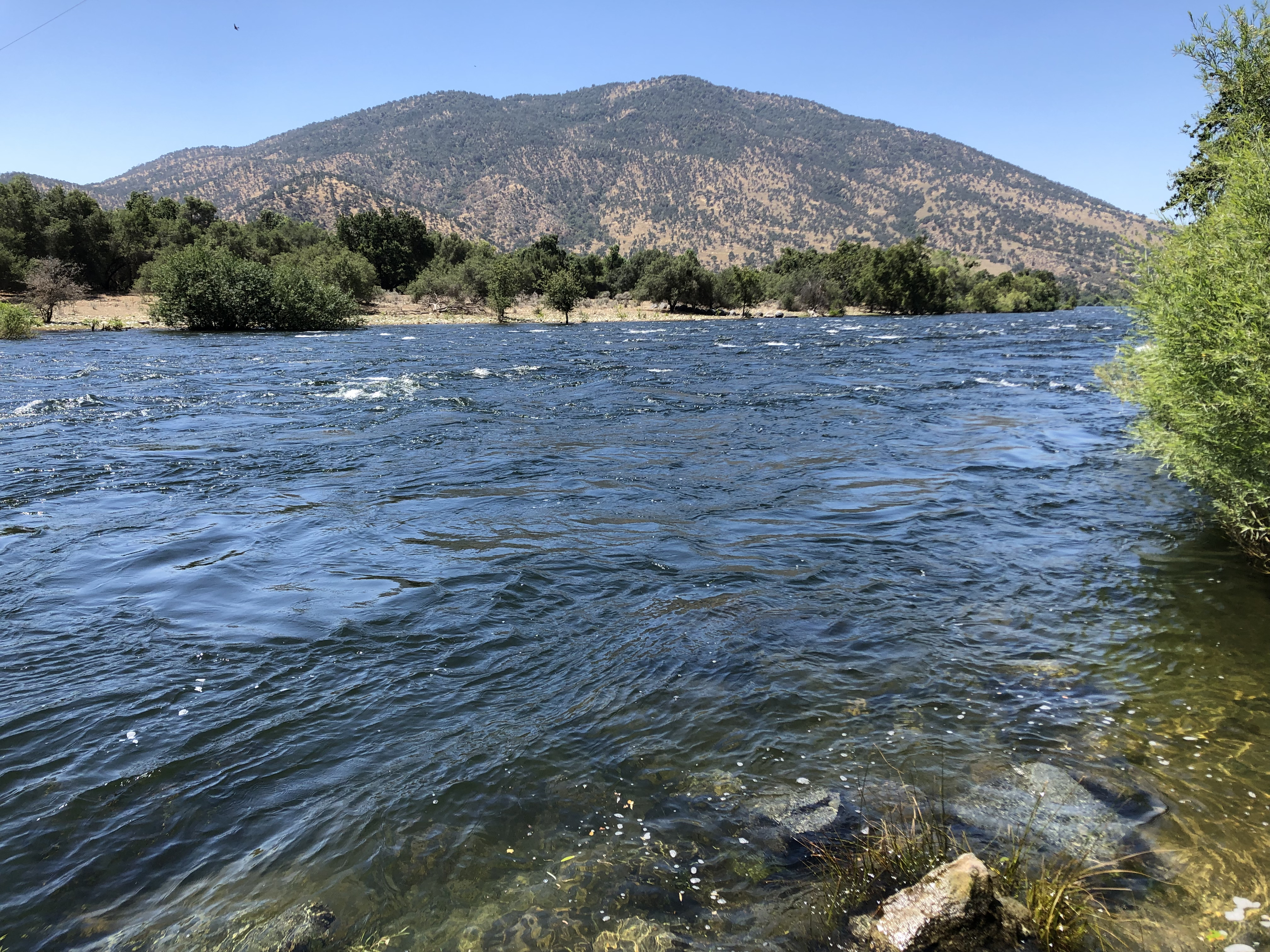
The natural and infrastructure systems within the upper San Joaquin River (1,680 square miles) and Tulare Lake Hydrologic Regions (4,730 square miles) originate within the Sierra and Sequoia National Forests. They have been significantly impaired by drought, effects of climate change, and massive tree mortality in the range of 80-100%. This has contributed to more frequent and greater intensity wildfire events with catastrophic consequences to ecological assets, infrastructure such as hydroelectric production facilities, and placing communities at risk. These forestlands do not have the ability to function properly as the largest natural carbon sink in California and as a source for nearly 65% of the high-quality water used for domestic and agricultural purposes.
The San Joaquin River and the Kings River are the principal rivers that influence the hydrology in Fresno County. The western slopes of the Sierra Nevada drain to the west via the San Joaquin and Kings Rivers.
These natural and infrastructure systems within the upper San Joaquin River (1,680 square miles) and Tulare Lake Hydrologic Regions(4,730 square miles) originate within the Sierra and Sequoia NationalForests and have been significantly impaired by drought, effects of climate change, and massive tree mortality in the range of 80–100%. This has contributed to more frequent and greater intensity wildfire events with catastrophic consequences to ecological assets, infrastructure such as hydroelectric production facilities, and placing communities at risk (CARs). These forestlands do not have the ability to function properly as the largest natural carbon sink in California and as a source for nearly 65% of the high–quality water used for domestic and agricultural purposesThese natural and infrastructure systems within the upper San Joaquin River (1,680 square miles) and Tulare Lake Hydrologic Regions(4,730 square miles) originate within the Sierra and Sequoia NationalForests and have been significantly impaired by drought, effects of climate change, and massive tree mortality in the range of 80–100%. This has contributed to more frequent and greater intensity wildfire events with catastrophic consequences to ecological assets, infrastructure such as hydroelectric production facilities, and placing communities at risk (CARs). These forestlands do not have the ability to function properly as the largest natural carbon sink in California and as a source for nearly 65% of the high–quality water used for domestic and agricultural purposesThese natural and infrastructure systems within the upper San Joaquin River (1,680 square miles) and Tulare Lake Hydrologic Regions(4,730 square miles) originate within the Sierra and Sequoia NationalForests and have been significantly impaired by drought, effects of climate change, and massive tree mortality in the range of 80–100%. This has contributed to more frequent and greater intensity wildfire events with catastrophic consequences to ecological assets, infrastructure such as hydroelectric production facilities, and placing communities at risk (CARs). These forestlands do not have the ability to function properly as the largest natural carbon sink in California and as a source for nearly 65% of the high–quality water used for domestic and agricultural purposes